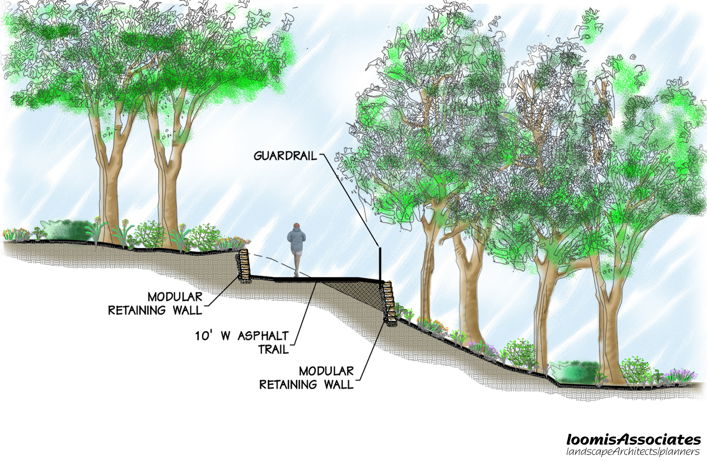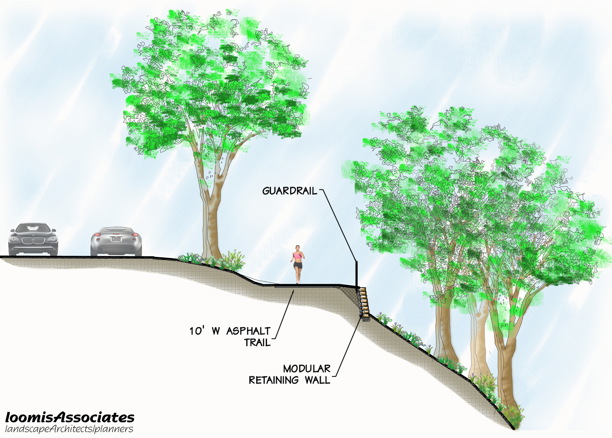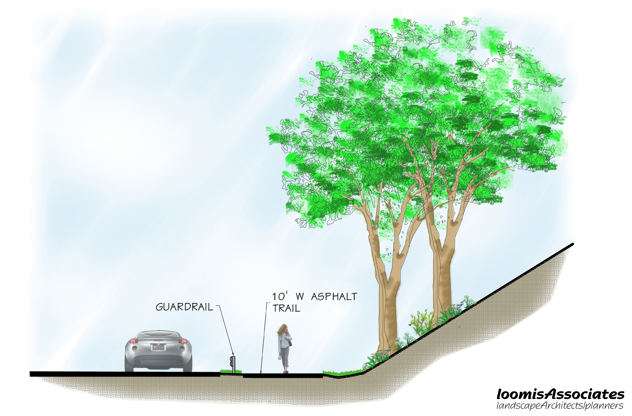
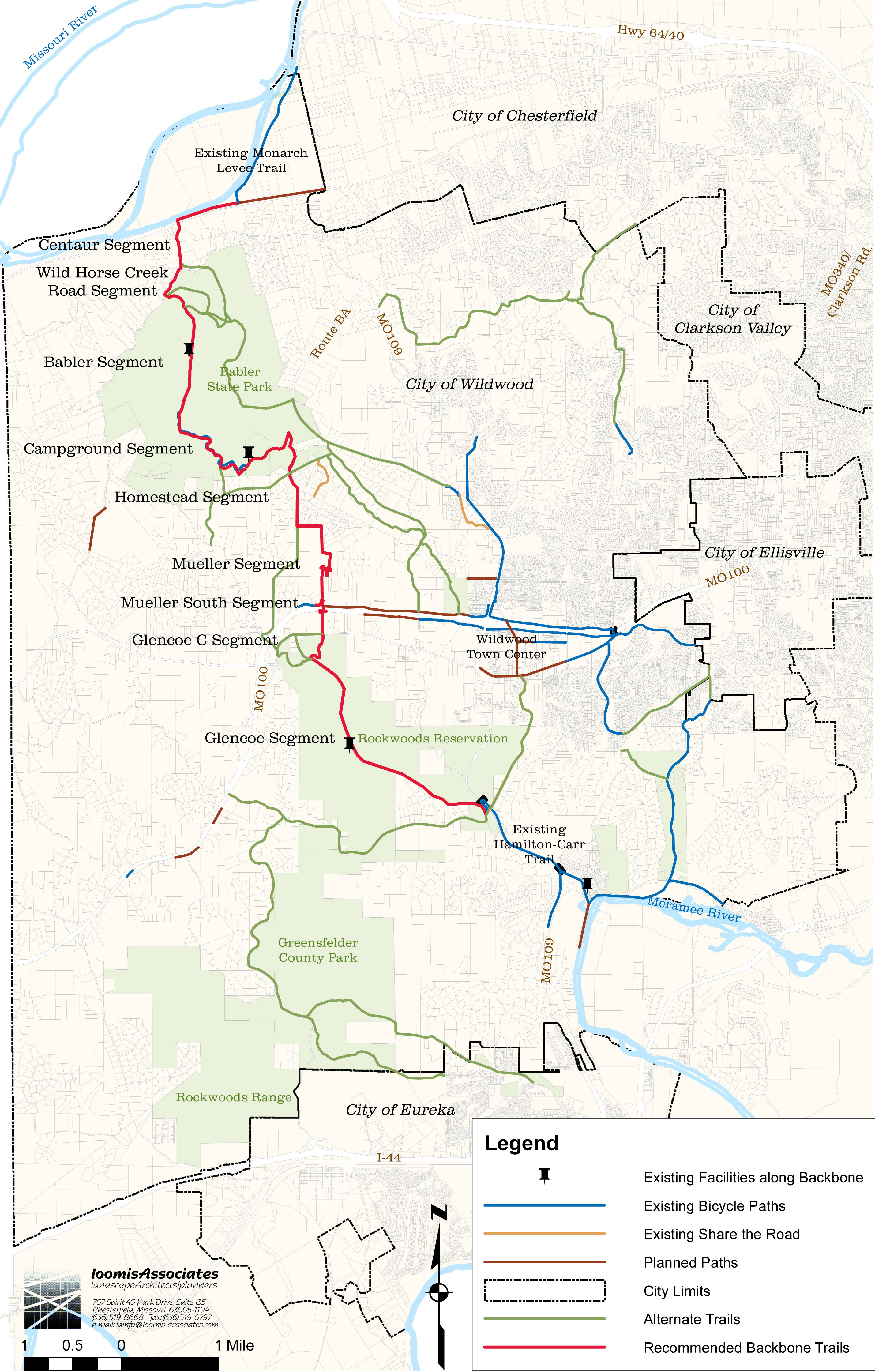
In a collaborative effort led by Intuition and Logic, the objective of the Western Greenway Alignment Study was to determine the best practical route for the proposed greenway. With northern and southern connection points already in place, the challenge was to establish a definitive route over rugged terrain with a variety of public and privately owned property. With GRG assistance, the team assembled a technical advisory committee consisting of key stakeholders. Included in the group were representatives of City of Wildwood, St. Louis County Parks, Missouri Department of Natural Resources and Missouri Department of Conservation. A series of workshop meetings were held to gather information, understand physical challenges, rate and rank preferences, discover ownership and site control limitations, consider options and alternatives, and make final recommendations. The Western Greenway Alignment Study made use of available GIS mapping and extensive photo documentation of field conditions. Study findings have become a workbook for future projects in the Greenway. The project was completed in a 12 month period.